

+copy2.jpg)


.jpg)
 This is probably one of the most informative maps of "Waddinxveen" that I have ever come across. It is meant to show when the various sections of what we today call Waddinxveen were first developed. It is generally accepted that Waddinxveen was 'founded' in 1233; for this see the section of land along the Gouwe south of the Dorrekade. It is also interesting to note that development in (the polder of) Bloemendaal started much earlier in 1138 as shown on the map. Another interesting observation is that the section of land between the Kerkweg and the Dorrekade belonged to Bloemendaal and not to Waddinxveen. It is said that this allowed the people from Bloemendaal (Bloemendalers), who did not have their own church, to walk to the church of Waddinxveen over their own land, apparently much to the annoyance of the people of Waddinxveen.
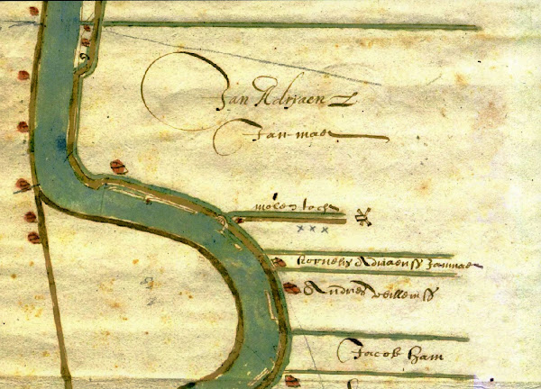
For more information about Waddinxveen visit the web site of the Janmaat Family and check out Album 4.


No comments:
Post a Comment